AI infrastructure has a physical footprint that is easy to underestimate from the outside. Training a model, running a query, storing data, these feel like weightless, invisible acts. They are not. Behind every AI interaction sits a data center drawing massive amounts of electricity, consuming significant volumes of water for cooling, and relying on a supply chain of critical minerals that requires its own extraction, refining, and eventual disposal. The scale of these demands is accelerating alongside AI adoption itself.
Each of these dependencies deserves a serious look. This is the first of three articles in which we examine the natural resource cost of AI infrastructure, starting with water, continuing with energy, and closing with the critical minerals and metals that make it all possible.
AI’s water problem starts below
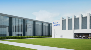
The AI servers never stop. Around the clock, in warehouse-scale buildings distributed across the American Southwest and beyond, the hardware powering artificial intelligence runs at full capacity, processing queries, training models, and storing the data that modern digital life depends on. The heat those servers generate is relentless. And the most reliable, cost-effective way to manage it is water.
This is the physical reality of the AI boom that rarely enters the conversation about infrastructure investment, site selection, or long-term operational planning and development. AI, besides being an energy and natural resource (i.e., water and critical minerals) problem, is also a water problem. And in the states most aggressively courting data center development — Texas, Arizona, Nevada, New Mexico — it is becoming a groundwater problem.

The question that most data center developers are not yet asking rigorously enough is a geological one: Is there enough water beneath this site to sustain data center operations for the next 20 years? Answering it requires looking below the surface, and doing so before the land is purchased or, even worse, when concrete is poured.
Data center sustainability encompasses multiple environmental dimensions, from resource utilization and land use to noise pollution. Four of the most pressing and measurable sustainability challenges for data centers are: power consumption, greenhouse gas (GHG) emissions, water consumption, and electronic waste (e-waste).
The scale of the demand
According to the 2024 United States Data Center Energy Usage Report from Lawrence Berkeley National Laboratory, U.S. data centers consumed approximately 17 billion gallons of water directly through cooling in 2023, with projections suggesting that figure could double or even quadruple by 2028. That estimate covers only direct on-site consumption. When indirect water use (the water required to generate the electricity that powers data centers) is included, the 2023 total rises to an estimated 211 billion gallons.
AI workloads are accelerating this trajectory. The computational demands of generative AI are dramatically more intensive than those of traditional data processing. More processing power means more heat. More heat means more cooling. And, in most facilities, more cooling means more water.
Texas: Holding the Tension Between Growth and Scarcity
A Bloomberg analysis found that over two-thirds of new data centers built since 2022 are located in drought-stressed areas. That is not an accident. It reflects the economics of land costs, tax incentives, and energy access that drive site selection decisions. But it is a risk that most of those decisions are not adequately accounted for.
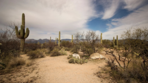
No state illustrates AI’s water problem more sharply than Texas. Attracted by a business-friendly regulatory environment, an independent energy grid, and abundant land, hyperscale data center operators have made Texas one of the fastest-growing data center markets in the country. OpenAI’s Project Stargate in Abilene is among the highest-profile examples of a development trend that shows no signs of slowing.
The water math, however, is sobering. The Houston Advanced Research Center (HARC) estimates that existing data centers in Texas will consume approximately 49 billion gallons of water in 2025. By 2030, that figure could rise to between 29 and 399 billion gallons. A wide range that reflects the significant gaps in publicly available consumption data. Even at the lower end of that projection, the trajectory is striking for a state that in 2024 saw the Edwards Aquifer drop 20 feet below its 10-year average, with over 70% of the state experiencing moderate to severe drought conditions.
Texas has begun responding legislatively by passing Senate Bill 6 to manage large-load energy users and allocating billions through Senate Bill 7 toward water infrastructure and conservation. But as the Texas Tribune has reported, the state still lacks a uniform method for tracking data center water consumption, and no equivalent regulatory framework exists specifically for their water use. That gap is consequential. Developers building in Texas today are making long-term water commitments in an environment of genuine hydrological uncertainty.
Arizona: Building in the Desert, Drawing from a Diminishing Supply
Arizona presents a paradox that is becoming increasingly difficult to ignore. The state is one of the most water-stressed in the nation. The Colorado River, its primary surface water source, has been in decline for years, and groundwater aquifers across the Phoenix metro area are under pressure from decades of over-extraction. In 2023, the state government placed a moratorium on new housing developments in parts of Maricopa County that depend on groundwater, citing insufficient supply.
And yet, hyperscale data center operators have swarmed into Arizona, attracted by the same economic incentives that draw them elsewhere. Microsoft, Meta, Apple, and Amazon all operate significant data center infrastructure in the Phoenix area. A Ceres analysis found that the proliferation of data centers could increase water stress in some Arizona areas by as much as 32% if all currently planned facilities come online, with annual water use from data center electricity demand alone projected to increase by 400% in the Phoenix region.
Some municipalities are responding. Mesa, Avondale, and the city of Phoenix have passed ordinances capping industrial water use and requiring developers to secure supplemental water supplies before exceeding those caps. But the regulatory landscape is uneven, and the fundamental hydrological question (whether there is enough reliably accessible groundwater to sustain planned development over the long term) remains incompletely answered for many proposed sites. Grist’s reporting on Arizona’s data center rush documents this tension in detail.
Nevada: The Driest State, and One of the Busiest Data Center Markets
Nevada is the driest state in the nation. More than half of its groundwater basins are overallocated — a condition sometimes described as “paper water,” where more water has been promised on paper than actually exists underground. It is also home to one of the country’s most rapidly growing data center markets.
The Tahoe-Reno Industrial Center, rising from the high desert outside Reno, is transforming into a global hub for data center infrastructure. About 60 data centers are already operating there, with a dozen more planned over the next decade. The water those facilities need is drawn primarily from the Truckee River, the same river that feeds Pyramid Lake, home of the Pyramid Lake Paiute Tribe, whose water rights and ecological interests have already brought them into conflict with industrial development in the basin.
In southern Nevada, data centers used 716 million gallons of water in 2024 alone. This comes as Lake Mead, the reservoir that supplies much of the region’s water, continues to face long-term drawdown pressures. Nevada has responded by banning evaporative cooling in new developments in southern Nevada, but the regulatory response has not kept pace with the rapid expansion of data centers across the state.
New Mexico and the Broader Southwest: A Regional Pattern
New Mexico fits into a pattern that extends across the entire American Southwest. A Nixon Peabody analysis found that over 40% of planned and existing U.S. data centers are located in areas classified as having high or extremely high water scarcity. New Mexico (arid, aquifer-dependent, and experiencing intensifying drought cycles) is part of that regional picture.
What makes the Southwest particularly challenging is not just the current state of water resources, but the trajectory. Climate change is shrinking mountain snowpacks, the primary mechanism by which the region recharges its rivers and aquifers each year. As the Desert Research Institute’s hydrologists have noted, those snowpacks function as the region’s water tower. As they diminish, the pressure on groundwater intensifies. Data centers being built today will still be operating in 2045. The hydrology of 2045 in the American Southwest will look meaningfully different from today’s.
The Subsurface Question That Site Selection Is Missing
Most data center site selection processes evaluate a familiar set of variables: land cost, site conditions, energy access, fiber connectivity, tax incentives, and proximity to population centers. Water availability is increasingly on the checklist. But it is typically assessed at the surface level through municipal supply agreements, projected utility capacity, or broad regional water-stress indices.
To solve AI’s water problem, a rigorous investigation of the site’s underlying conditions is needed. Municipal supply agreements can be modified, capped, or disrupted by drought conditions or competing demand. Regional water stress indices describe conditions across wide geographies, not the specific aquifer system beneath a given parcel. The question that matters for long-term operational sustainability is more precise: what is the groundwater availability, depth, quality, recharge rate, and structural geology beneath this site, and is it sufficient to sustain the planned facility’s water demand over its operational life?
That question requires subsurface investigation. And subsurface investigation, done rigorously, requires geophysical surveys integrated with geological and hydrological interpretation.
What Geophysics Adds to the Site Selection Equation
Geophysical surveys provide non-invasive, continuous, high-resolution imaging of subsurface conditions across a site before any ground is broken. For data center developers and water resource planners, the most relevant capabilities include:
- Aquifer mapping and characterization — identifying the location, depth, lateral extent, and structural integrity of groundwater-bearing formations beneath a site.
- Recharge rate assessment — understanding how quickly an aquifer replenishes, which is critical for evaluating whether sustained extraction is viable over a 20- to 30-year operational horizon.
- Water quality evaluation — detecting salinity, contamination, or mineralogical conditions that could affect the suitability of groundwater for cooling system use.
- Structural geology interpretation — mapping faults, fracture zones, and subsurface heterogeneities that influence how water moves through the natural hydrogeological system and how reliably it can be extracted.
Methods such as electrical resistivity imaging (ERI), passive electromagnetics (EM), transient electromagnetics (TEM), and seismic surveys can map these conditions efficiently and across large areas, without excavation, without disruption to the site, and well before construction commitments are made.
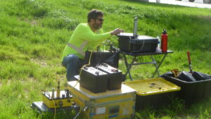
Critically, the value of geophysical data is not in the raw measurements. It is in the geological interpretation that follows. An experienced geoscientist reading the results of a multi-method survey can distinguish between an aquifer with genuine long-term yield potential and one that appears promising on a single resistivity pass but is too thin, too poorly recharged, or too structurally compromised to sustain the extraction rates required by a large data center. That interpretive layer is where sound decisions are made.
The Challenge Does Not Stop at the Border
The water-AI tension is not a uniquely American problem. Mexico is beginning to attract data center investment of its own, and in a country where large portions of the territory are classified as arid or semi-arid, and where groundwater is already under significant stress in many regions, the subsurface questions are just as consequential. As the World Economic Forum has noted, water availability and resilience assessments should be compulsory for any developer building data center infrastructure in water-stressed geographies, on either side of the border.
Infrastructure Built to Last Starts With What Lies Beneath
The AI infrastructure boom is real, it is accelerating, and it represents a genuine opportunity for the states and regions that can support it sustainably. But sustainability, in this context, is not a values statement. It is an operational requirement. A data center that cannot secure a reliable, long-term water supply is a stranded asset.
The developers, investors, and infrastructure planners who will succeed over the next two decades are the ones who understand that site selection is not complete until the subsurface has been investigated with geophysical surveys, geological interpretation, and the kind of precise, geotechnical, and hydrogeological site-specific clarity that turns a promising location into a defensible long-term commitment.
That is the question AI infrastructure needs to start asking. And the answer, as with so much else, begins below the surface.
Is your site’s water supply as secure as your energy supply?
If your team is evaluating sites for data center development and needs geoscience-based guidance on groundwater availability, aquifer characterization, or subsurface site assessment, we would welcome the conversation. Cordillera Geo-Services brings certified geoscience expertise, a multi-method geophysical approach, and deep familiarity with the geological environments of Texas, the broader US Southwest, and the US-Mexico corridor.