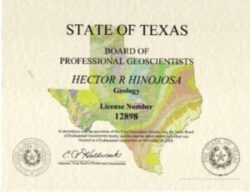
Dr. Hector Hinojosa is part of and collaborates with:



We all need water; as the population grows, climate changes, more housing and industries are built, and ecosystems develop, water demand increases.
The challenge to meet the demand for water is still very present.
The water cycle on Earth is still replenishing our sources of vital liquid, but we need to find more aquifers and groundwater to provide water to more people in better ways. The need for water continues to grow, and our sources aren’t being replenished as fast.
Whether you need water for agriculture, domestic, industrial, or commercial use, Geophysics and Geology can help you locate untapped sources of groundwater that help with the demand-supply unbalance.
Through geophysical and geological exploration methods, you can detect the presence of water that can be used for your civil, industrial, agricultural, or commercial projects.
Through Geophysics and Geology, you can discover new aquifers that can be used to provide water for your projects.
1. REVIEW OF EXISTING GEOPHYSICAL STUDIES
Obtain better interpretations by analyzing all previous explorations.
With Cordillera Geo-Services, you can be sure the understanding of the data will be based not just on current findings of underground water but also on prior studies to get better clues of what lies below the surface.
2. SURVEY DESIGN
Pick the right exploration method to get reliable data.
After reviewing existing studies, with the help of Cordillera Geo-Services, you can determine the Geophysical Exploration Method needed to explore the ground and find new sources of water.
3. FIELD GEOPHYSICAL EXPLORATION
Get a better picture of what lies below the surface.
Conducting the survey itself requires great care. With Cordillera Geo-Services on your team, you can be sure the setup will be precise, and all noise sources will be considered so that when you gather data, you get quality assessments.
4. ACCURATE DATA GENERATION
Work with state-of-the-art measuring equipment.
Dr. Hector Hinojosa will ensure the necessary instruments and the right software are in place to generate the data needed to produce 2D or 3D models of the water deposits.
5. DUAL INTERPRETATION OF DATA
Explore the surface and subsurface from different angles.
Not only does Dr. Hector Hinojosa evaluate existing studies and the data generated from a Geophysical point of view, but he also adds his Geological perspective to the interpretation. This improvement reduces uncertainty and yields robust reports on a particular site.
Applications:
- Water table mapping
- Mapping groundwater pollution
- Contaminant plume mapping
Identify areas to explore or drill so your water discoveries are more accurate.
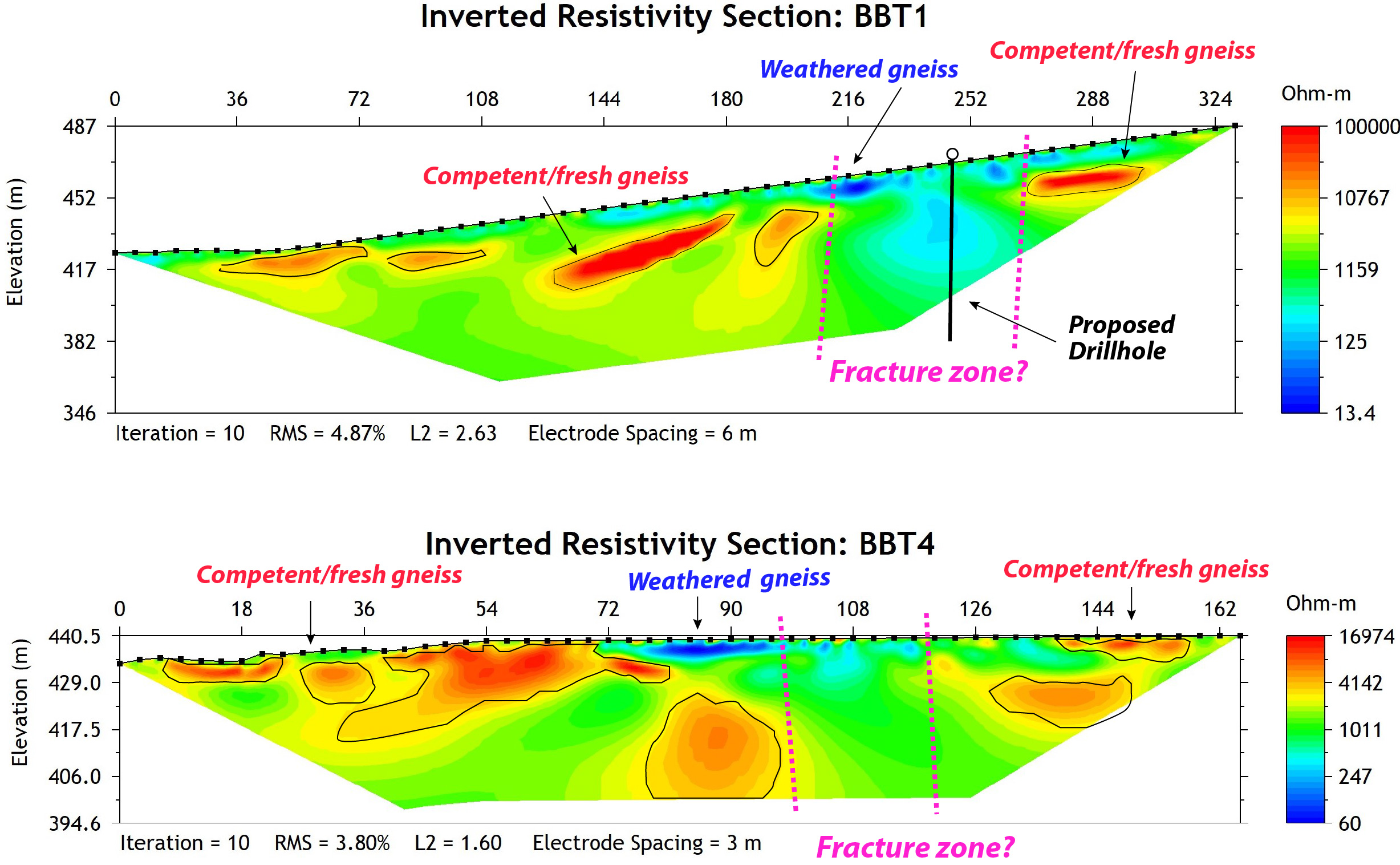
“Sought Cordillera Geo-Services’ assistance to inform me of voids and optimal water well locations in my land using a 2D electrical resistivity imaging study. They were extremely helpful, timely, and expertly professional from my first phone consultation through to their final report. I requested a copy of the raw data files from the readings, which they happily provided.”
– BENJAMIN BARTON, Home owner.
Planning to face the lack of water is key to continuing industrial, commercial, and civil operations. Not to mention survival.
When you run a survey with us, you will be able to:
- Detect the presence of aquifers, groundwater, and other geophysical and geological features needed to plan your water extraction.
- Identify variations in soil composition and determine if you need to mitigate hazards due to natural resource extractions or changes in the geological landscape.
- Determine if the soil is suitable for construction.
Furthermore, with the right exploration methods and interpretation of data, you eliminate:
- Wrong assumptions of what lies in the subsurface.
- Unnecessary drilling and unplanned expenses.
- Accidents due to poor geological assessment.
- Delays in the exploration.
- Undetected sources of groundwater or unsuitable soil.
What you get from a free consultation with us:
What you get from a free consultation with us:
An initial project assessment.
Suggested geophysical exploration methods.
Determination of deliverables like 2D or 3D images.
Custom roadmap of the exploration, analysis, interpretation, recommendations, and delivery of results.
Plan delivered to your email in a few days.
Professional service in English or Spanish.
Fully licensed and certified.
