Dr. Hector Hinojosa is part of and collaborates with:




Understand the subsurface before you change the landscape.
You know that success begins with the right plan. Geophysical surveys can help you map a sound project for profitable land development.
By understanding the landscape below the surface – from soil composition to bedrock – you can make better decisions about how to use the land. For example, think of locating underground utilities, infrastructure, and geological hazards and considering that before you change the landscape.
Geological and geophysical techniques also help you determine the best location for residential or commercial buildings, how much earth needs to be excavated, and where to build roads and utilities.
They also provide information about the physical properties of soils and rocks so that you can improve foundation design, slope stability analysis and determine the suitability of the ground for construction purposes.
It gathers the right data about a site before breaking ground and sending out excavators.
Big projects like this require care, and with the help of Cordillera Geo-Services, you can be sure you’ll be able to run a solid geological and geophysical assessment of the land you want to develop.
Identify environmental hazards or geologic features that could cause problems during construction, mitigate risks, and plan for a successful project.
1. REVIEW OF EXISTING GEOPHYSICAL STUDIES
Obtain better interpretations by analyzing all previous explorations.
With Cordillera Geo-Services, you can be sure the understanding of the data will be based not just on current soil findings but also on prior studies of the land to get better clues of what lies below the surface.
2. SURVEY DESIGN
Pick the right exploration method to get reliable data.
After reviewing existing studies, with the help of Cordillera Geo-Services, you can determine the Geophysical Exploration Method needed to explore the ground and assess its features.
3. FIELD GEOPHYSICAL EXPLORATION
Get a better picture of what lies below the surface.
Conducting the survey itself requires great care. With Cordillera Geo-Services on your team, you can be sure the setup will be precise, and all noise sources will be considered so that when you gather data, you get quality assessments.
4. ACCURATE DATA GENERATION
Work with state-of-the-art measuring equipment.
Dr. Hector Hinojosa will make sure the necessary instruments and the right software are in place to generate the data needed to produce 2D or 3D images of the location of groundwater, subsidence, underground voids, caves, possible sinkholes and to determine the characteristics of the soil.
5. DUAL INTERPRETATION OF DATA
Explore the surface and subsurface from different angles.
Not only does Dr. Hector Hinojosa evaluate existing studies and the data generated from a Geophysical point of view, but he also adds his Geological perspective to the interpretation. This improvement reduces uncertainty and yields robust reports on a particular site, written in a geological context. Perfect if you want to make the most of your land development.
Detect underground karstic features to avoid damaging the environment and follow preservation requirements.
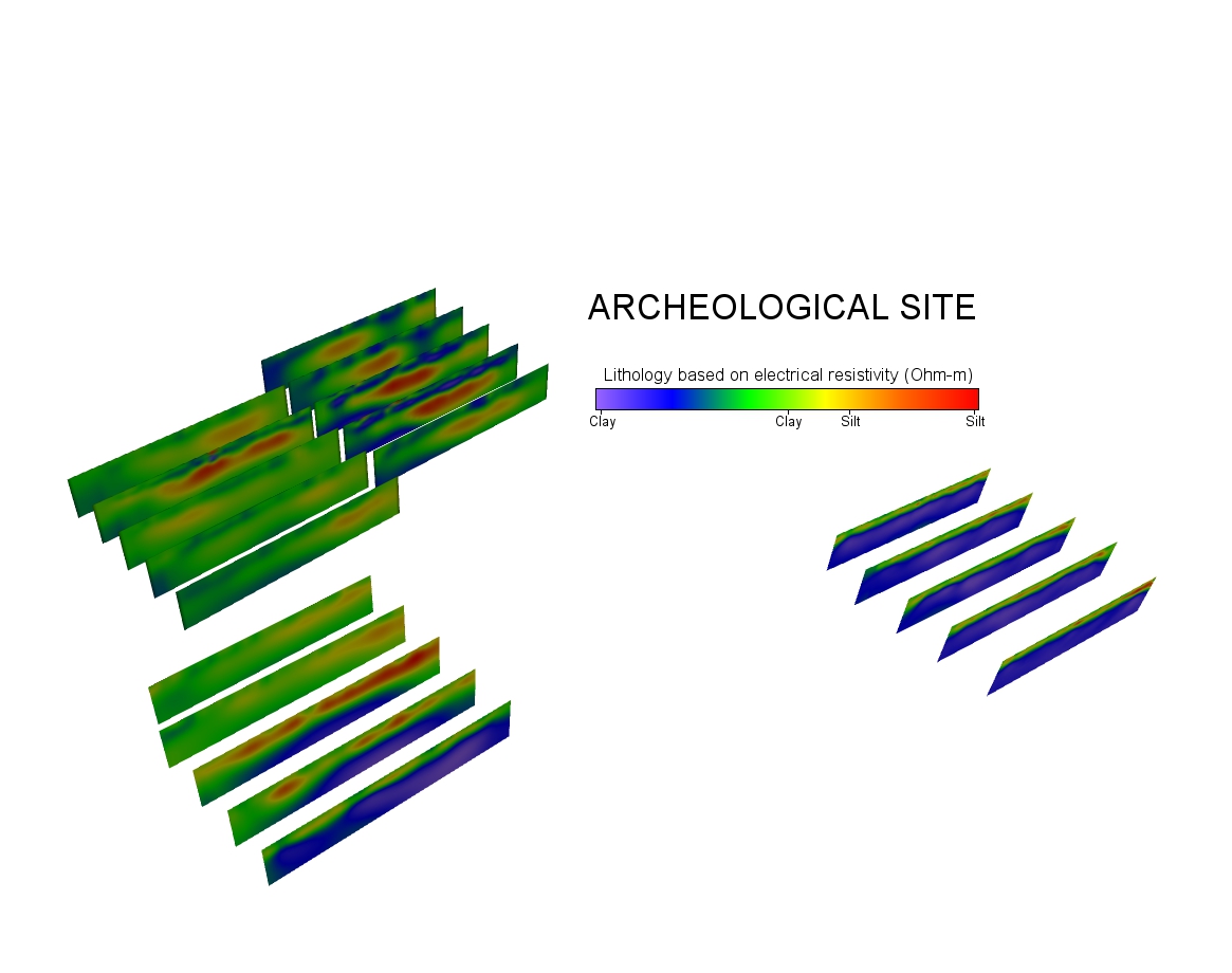
“Through the use of high-resolution 2D electrical resistivity imaging, Cordillera Geo-Services, LLC was able to provide archeologists working at site 41FN298 on the North Sulphur River floodplain in Fannin County, Texas a look into the subsurface to determine where their excavations should be focused and most fruitful. By distinguishing flood basin facies from channel fill facies through high-resolution 2D electrical resistivity imaging, archaeologists were able to determine where archaeological materials at the site are more likely to be in a primary context from areas of the site where archaeological materials (if present) are likely to lack past behavioral meaning and interpretative value due to the erosion, transport, and deposition of these materials from their original archaeological context.”
– KARL KIBLER, Geoarcheologist.
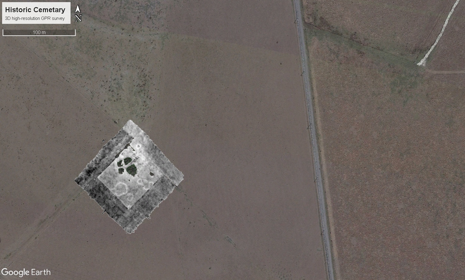
“Cordillera Geo-Services conducted a geophysical survey on a historic cemetery using a high-resolution 3D ground penetrating radar (GPR) and delivered the results that confirmed suspicions. This assisted our client in determining the potential extent of the cemetery and its potential impacts on development. Based on the survey, the project was able to proceed and meet regulatory requirements. Cordillera Geo-Services was very professional throughout the project. The results provided clear insights in a technical report.”
– Environmental Engineer who asked to remain anonymous.
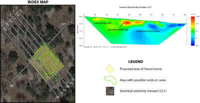
“Cordillera Geo discovered voids that could pose a problem in our construction. They were extremely professional throughout the project and explained in detail their planned efforts in advance, we discussed and agreed on the scope of the project, and they worked diligently to complete the work in a timely manner, providing a very professional and detailed survey report upon completion. The results were excellent and well received by our General Contractor.”
– MIKE CARDOZA, Engineer and home owner.
Geophysics can aid you in the planning and design of infrastructure projects such as roads, bridges, and tunnels.
When you run a survey with us, you will be able to:
- Detect the presence of saturated moisture, sinkholes, voids or even groundwater that affects the surface so you avoid soil unsuitable for residential or commercial building projects, or transportation infrastructure.
- Identify variations in soil and bedrock composition and determine if you need to mitigate hazards due to changes in the geological landscape.
- Locate the best areas to build utilities needed in your residential or commercial building project.
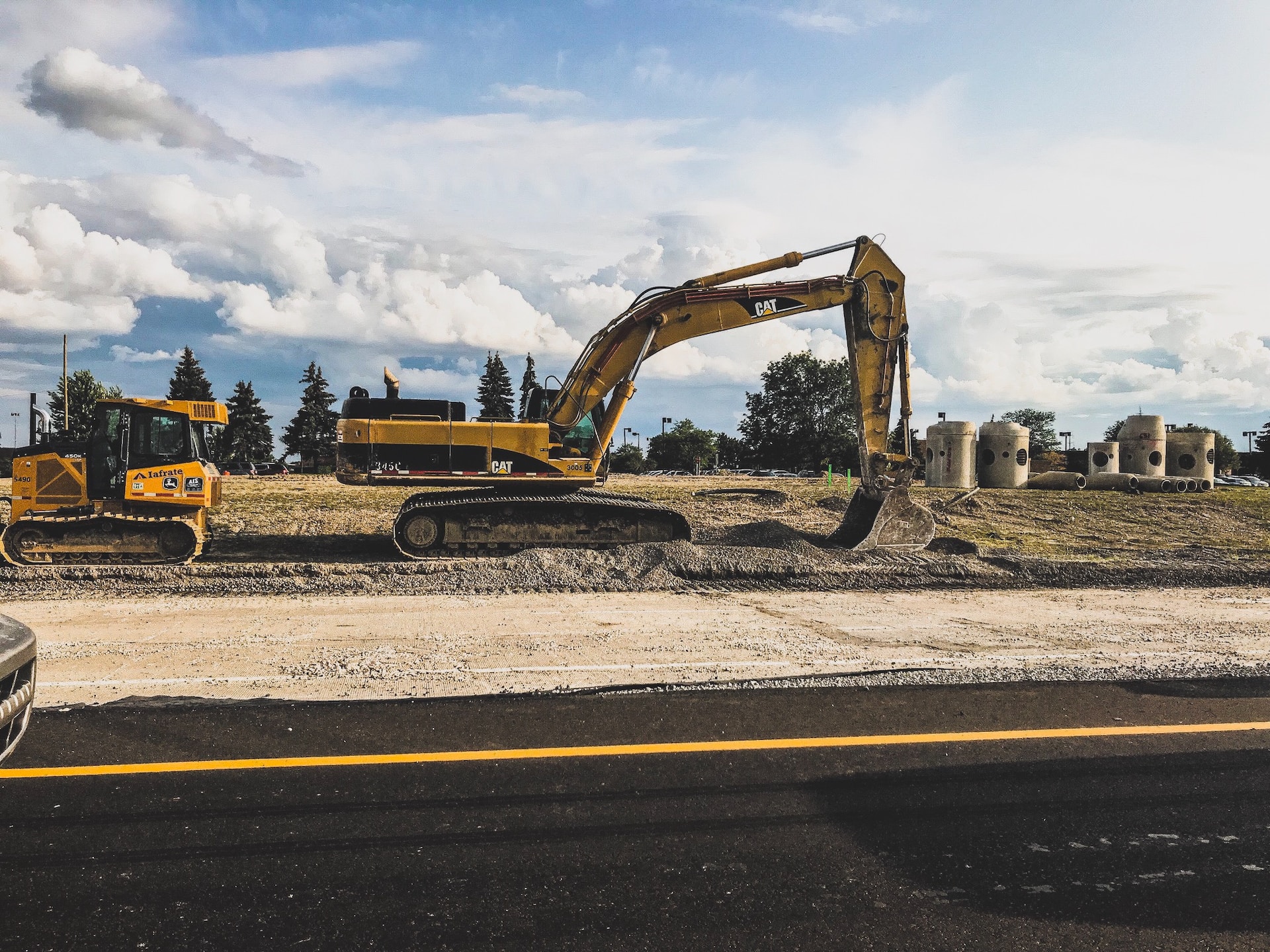
Furthermore, with the right exploration methods and interpretation of data, you eliminate:
- Unexpected challenges during construction, such as encountering unstable soils, geological hazards, contaminated soils, hidden rock formations, or groundwater issues.
- Costly delays, design modifications, or even construction failures.
Potential geotechnical hazards, such as landslides, sinkholes, or seismic risks. - Environmental impact that may violate regulations and lead to fines.
- Damages to existing infrastructure during construction result in service disruptions, safety hazards, and additional repair costs.
Fully licensed and certified.
