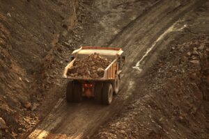
Every mining operation begins with claims or mining concessions. And claims, by their nature, are broad. They cover the ground you believe might hold value — the areas where geology and alteration suggest mineral potential, where historical data points toward something worth investigating. But belief and data are not the same thing. And in the space between them, exploration budgets bleed.
In many jurisdictions across the United States and Latin America, mining companies are assessed taxes or fees based on the surface area of their claims. The larger the mining concessions, the larger the obligations — regardless of whether every hectare within it holds any real mineral potential. This creates a pressure that every exploration manager knows well: you are paying to hold ground you may never develop. When you don’t pay, governments may take them back.
The question is not whether to reduce your claim footprint. The question is how to do it intelligently — without abandoning ground that could be your next discovery.
The Real Cost of Holding Undifferentiated Mining Concessions
Large claim areas are a necessary feature of early-stage exploration (i.e., greenfield or grassroots exploration). When you don’t yet know where the mineral deposit lies, you hold more ground to preserve optionality. That logic is sound — until it isn’t.
The problem arises when exploration programs advance without the subsurface intelligence needed to distinguish prospective zones from non-prospective ones. When that differentiation is absent, companies face a difficult set of choices:
- Hold the entire claim area and absorb the associated tax burden, spreading capital across ground that may never yield a viable target.
- Relinquish portions of the claim arbitrarily — based on surface observation or intuition rather than subsurface evidence — and risk giving up ground that conceals something valuable.
- Drill aggressively across the claim in search of clarity — a costly and time-consuming approach that often generates more questions than answers in complex geological environments.
None of these options is satisfying. All of them reflect a common underlying problem: insufficient subsurface knowledge at the point when decisions about claim management need to be made.
What Zone-of-Interest Mapping Actually Does
Zone-of-interest mapping is the process of using geophysical surveys, airborne or ground, combined with geological, structural, and geochemical interpretation, to identify which areas within a claim have the subsurface characteristics consistent with mineral potential, and which do not.
This is not a single method or a simple scan. It is an integrated, multi-method investigation designed to build a coherent picture of what lies beneath the surface across the full extent of a claim area. Depending on the geological setting, the target mineralogy, and the terrain, this may involve:
- Electromagnetic (EM) surveys to detect conductive zones associated with sulfide mineralization or graphite horizons.
- Induced Polarization (IP) to identify shallow disseminated sulfides or porphyry-style alteration that may not be apparent at the surface.
- Magnetic surveys to map structural controls, lithological boundaries, and alteration halos that commonly host ore deposits.
- Gravity surveys to detect density contrasts associated with intrusive bodies, stratigraphic horizons, or structural features relevant to mineralization.
- Seismic methods to characterize deeper or shallower structural architecture and basin geometry in sediment-hosted or hydrothermal systems.
Critically, the output of these surveys is not raw data. It is interpreted data, translated through geological expertise into actionable guidance. This distinction matters enormously. Geophysical anomalies are only meaningful when understood within their geological context. An experienced mineral exploration geoscientist can distinguish between a conductive zone that warrants immediate follow-up and one that reflects a lithological background with no exploration significance. Without that interpretation layer, even the best survey data can mislead.

From Survey to Strategy: How Cordillera Geo-Services Approaches the Problem of Mining Concessions
At Cordillera Geo-Services, we approach zone-of-interest mapping as a strategic exercise, not merely a data-collection task. Our work begins with a thorough review of the available geological and structural information of mining concessions — regional geology, structural history, alteration patterns, and any existing geochemical or geophysical data — before a single instrument is deployed in the field.
This review informs and feeds the geophysical survey design. Rather than applying a generic methodology across an entire claim, we select and integrate the methods most likely to yield a meaningful signal for the specific geological environment and target type at hand. This targeted approach is more efficient, more informative, and more cost-effective than broad-coverage surveys that are not calibrated to the local geology.
The final deliverable is not a series of geophysical maps. It is a clear, geologically grounded assessment of which areas of the claim warrant continued investment, and which do not. This provides exploration managers and project executives with the evidence they need to make data-based, defensible decisions on claim retention, relinquishment, and drill targeting.
The Business Case for Acting Early
The earlier in an exploration program you can distinguish prospective from non-prospective mining concessions, the more efficiently you deploy your capital.
Every drilling program targets the ground that geophysics and geology say is most likely to deliver a result. Every relinquishment decision becomes defensible rather than arbitrary. Every tax or fee assessment applies to a leaner, more purposeful claim footprint. And every dollar not spent on low-probability targets is a dollar available for high-confidence ones.
This is the compounding value of subsurface clarity: it does not just improve one decision. It improves the entire decision architecture of an exploration program.
There is also a less discussed but equally important dimension to this: the confidence with which exploration results can be communicated to investors, partners, and regulators. When decisions are grounded in integrated geophysical and geological evidence, they carry a credibility that gut-feel or surface-based conclusions simply cannot match. In environments where social license and stakeholder trust are increasingly decisive, that credibility has real strategic value.
A Note on Complex Terrain
In many geological environments, zone-of-interest mapping faces challenges that require specific expertise to navigate.
Rugged terrain, complex structural settings, volcanic cover sequences, folded and faulted stratigraphy, and near-surface conductive material can all generate noise that obscures or distorts geophysical responses. In these settings, single-method surveys frequently fail to provide the resolution needed to make confident decisions.
This is precisely why the geophysical multi-method, geologically integrated approach is not optional — it is essential. The ability to cross-reference results from multiple independent geophysical methods and to interpret them against a sound geological model of the area is what separates a useful investigation from an inconclusive one.
Exploration Should Be Focused, Not Sprawling
The economics of mineral exploration are unforgiving. Capital is finite, timelines are pressured, and the cost of a misallocated drill program compounds quickly. In that environment, the most valuable thing an exploration team can have is not more ground, but a clearer understanding of the ground they already hold.
Zone-of-interest mapping, done rigorously and interpreted with genuine geological expertise, gives exploration companies exactly that: the clarity to know where to focus, the confidence to justify those decisions, and the financial discipline to stop paying for mining concessions that will never pay back.
At CGS, this is what we are built to do. Not just to survey — but to help you make better exploration decisions, from the ground up.
Ready to focus your exploration program?
If your team is evaluating mining concessions and needs science-based guidance on where to concentrate resources, we would welcome the conversation. Our team brings certified geoscience expertise, a multi-method approach, and deep familiarity with the geological environments of the US–Mexico corridor.
Schedule a consultation with us.